
Seattle's Ship Canal squeeze starts miles before the bridge
Northbound I-5 is down to two lanes across Seattle's Ship Canal Bridge through the end of 2026. The useful plan begins before the queue, with the right access point, departure window, and recovery route.
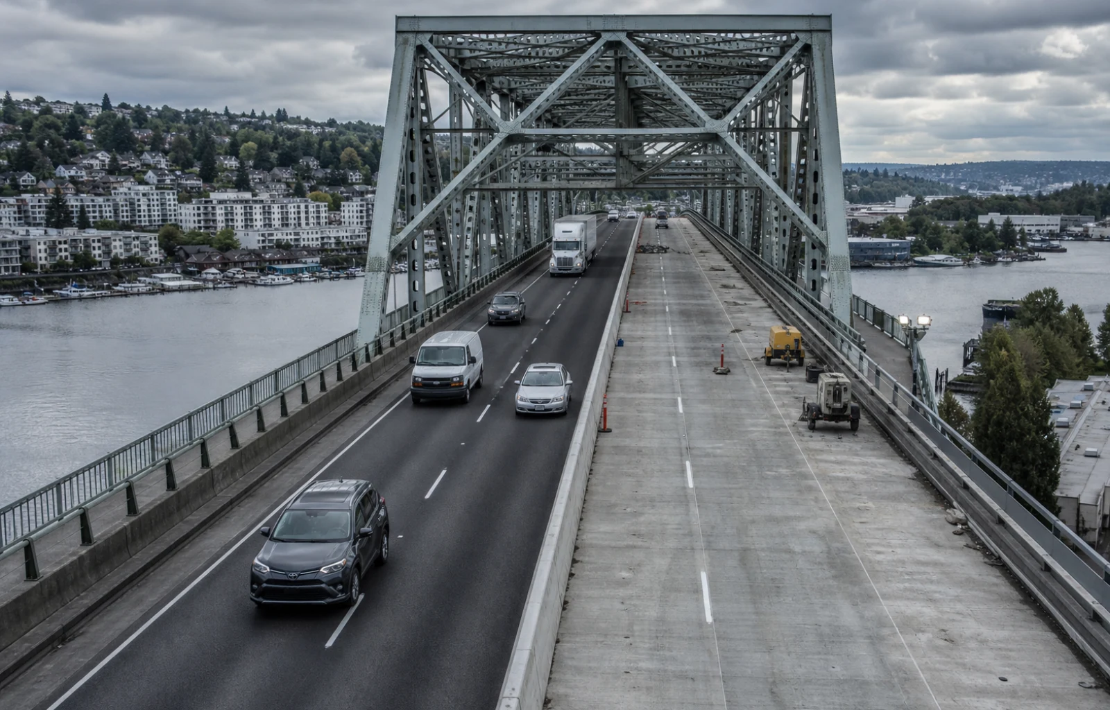
Northbound Interstate 5 is reduced from four lanes to two across Seattle's Ship Canal Bridge, and WSDOT says the configuration is scheduled to remain through the end of 2026. The two right lanes are the work zone; traffic is using the two left lanes while crews repair and resurface the upper bridge deck.
This is a corridor constraint, not a brief lane closure. WSDOT says almost 240,000 vehicles cross the bridge each day, connecting homes, hospitals, universities, stores, job sites, ports, and delivery routes on both sides of the canal. A delay at that crossing can change arrival times well beyond the bridge itself.
The work addresses an old structure rather than a temporary defect. I-5 through Seattle was built in the 1960s, and WSDOT says the Ship Canal Bridge last received a major preservation effort about 40 years ago. The current project includes concrete repair, deck resurfacing, expansion-joint replacement, drainage work, and other maintenance, with northbound construction in 2026 and southbound work planned for 2027.
The surrounding lane plan matters as much as the barrier line. WSDOT is keeping the I-5 express lanes northbound-only around the clock through the end of 2026, so they are not available for the usual directional change. The Harvard Avenue on-ramp to northbound I-5 is closed until mid-October, while the temporary pattern is designed to preserve access to the Northeast 45th and 50th Street exit.
That combination rewards decisions made before downtown. A family trip, service call, delivery, or appointment should confirm the intended entrance and exit before reaching the constrained section. Commercial vehicles also need to keep route suitability in the calculation: a local street that appears to bypass the queue may add tight turns, neighborhood traffic, delivery restrictions, or a difficult return to the freeway.
Industry sponsor Built for carriers that want one operational view.
Meet Pro FleetSync ↗
Built for carriers that want one operational view.
Meet Pro FleetSync ↗
The likely operating effect is that congestion can spread to approaches and parallel streets when demand exceeds the two open lanes; that is an inference from the reduced capacity, not a prediction of a specific wait. Actual conditions depend on time, incidents, events, and weather, so WSDOT's real-time travel map should control the final go-time decision.
The practical route brief is short: check the live map before entering central Seattle, verify the ramp sequence, decide whether a different departure window is realistic, and choose a safe place to recheck if conditions change. Passengers and dispatchers can handle the update while the driver keeps attention on the narrowed roadway. The bridge work will last for months, but each trip still needs today's answer.
Route check
- Check WSDOT's real-time map before committing to northbound I-5 through central Seattle.
- Account for northbound-only express lanes and the Harvard Avenue on-ramp closure.
- Verify any local alternate before the trip instead of improvising at the queue.