
The next highway AI rollout has to fit the control room
FHWA posted a national AI road map Monday, while a federal evaluation of Tennessee's I-24 deployment shows both the promise and the limit: software can spot a forming problem early, but road operators still need warnings they can verify and use.
A national highway AI plan moved from general ambition to a named road map this week. The Federal Highway Administration's research office posted its AI for Safety and Efficiency Program Roadmap on August 24 and classified it as safety research and technical direction. That makes the subject national, but the useful road question is narrower: what can a system recognize early enough for a human control room to change the trip?
FHWA's Artificial Intelligence Deployment Center of Excellence says it is building a national resource for AI use in surface-transportation planning, operations, maintenance and investment decisions. The center describes playbooks, reference frameworks and scalable approaches rather than one mandatory traffic-control product. A road map is therefore a program signal, not evidence that every state has installed the same system or that software has been given final authority over signs.
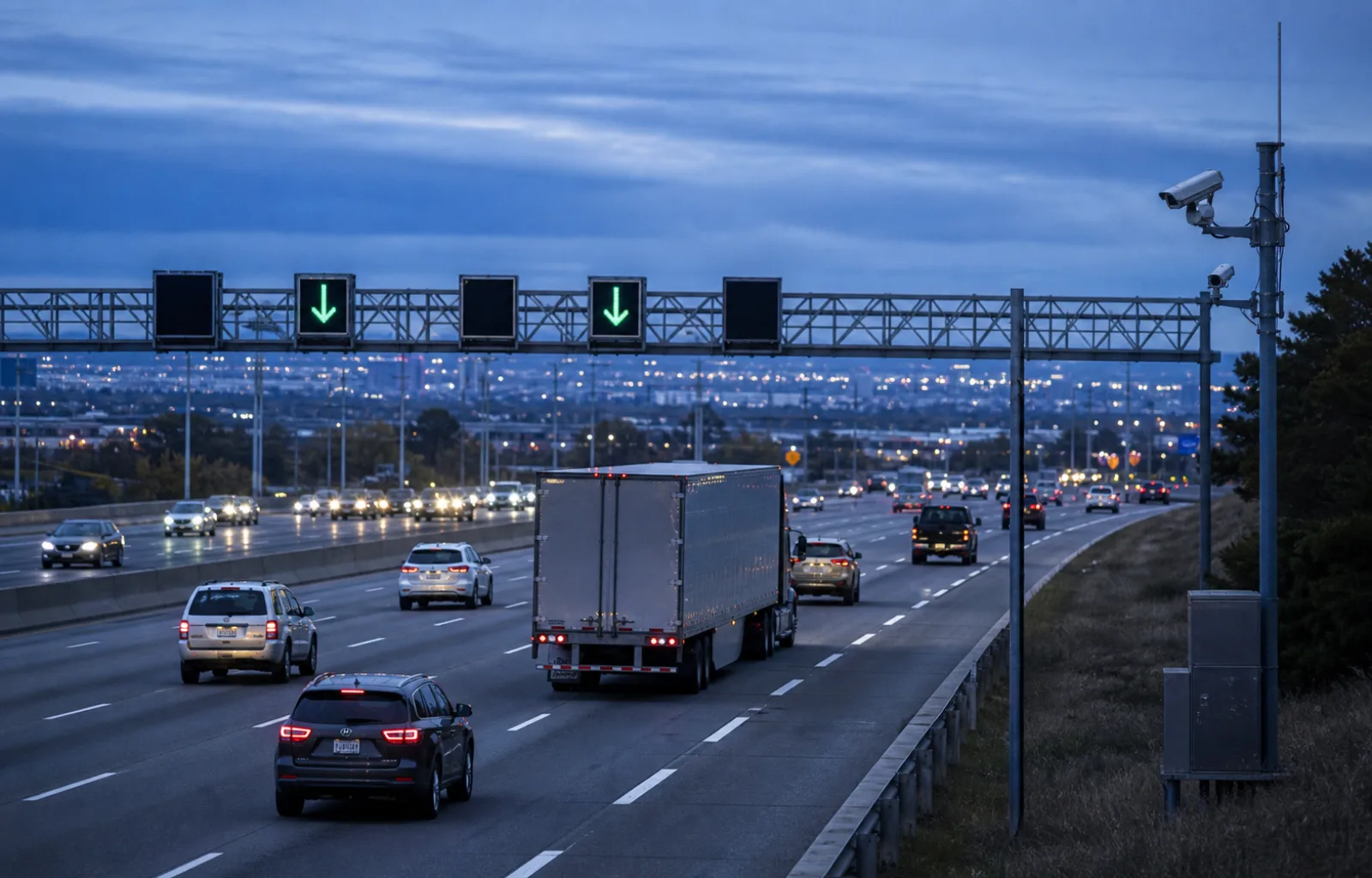
A deployed example on Interstate 24 between Nashville and Murfreesboro helps put pavement under the idea. A federal Intelligent Transportation Systems evaluation posted July 27 describes an AI-based decision-support system using traffic and incident data from cameras, radar, electronic signs and Tennessee's SmartWay software. The system recommends actions to transportation-management-center staff, including variable speed limits, lane-control messages, traveler information and signal timing; the summary does not describe an unattended machine making every road decision.
Industry sponsor Fewer handoffs. Better visibility. Stronger operations.
See how it works ↗
Fewer handoffs. Better visibility. Stronger operations.
See how it works ↗
The reported results are substantial enough to study and specific enough not to oversell. When the variable-speed system was active, the evaluation says the monthly crash rate fell 14 percent, from 18.4 to 15.8 crashes, while the secondary-crash rate fell from 7.2 to 3.6 crashes per month. It also reports that warnings appeared an average of nine minutes before a crash was reported to the control center and that incident-clearance time declined 20 percent.
Those numbers are not a universal forecast for the next corridor. The underlying final report used a before-and-after design, comparing about two and a half years before deployment with a year and a half after it. The report itself discusses changing demand, incidents, construction, weather and data availability as factors that complicate comparisons. The defensible conclusion is that I-24 produced encouraging measured results, not that an AI label guarantees a fixed safety return elsewhere.

The operator's attention is part of the system. A separate federal summary of machine-learning work with state transportation departments says Missouri reduced one crash-risk alert stream from roughly 70 locations to five locations in each three-hour period so control-room staff could act on it. That example turns a software metric into a road rule: an alert that arrives too often, too late or without a clear response can be technically correct and operationally useless.
For people already on the road, the display remains the instruction. Drivers should follow the speed limit, lane arrow, closure message and directions actually posted by the responsible agency, then use the state's live 511 or traveler-information service for current conditions. It would be an editorial inference—not a finding in the FHWA road map—to assume a green arrow means congestion has disappeared beyond the next gantry or that an automated recommendation has removed the need to scan the queue ahead.
For freight operations, the transferable value is less glamorous than autonomous driving. Earlier recognition of a speed collapse can give a control center more time to slow approaching traffic, protect an incident scene and reduce the chance that one crash becomes another. That can matter to a loaded tractor-trailer with more stopping distance and fewer easy lane choices, but no published corridor average can substitute for the driver's view, posted controls or actual road and weather conditions.
Agencies considering the next deployment should make the handoff visible: identify the sensor inputs, the person or rule that approves a change, the fallback when data go stale, the way false warnings are reviewed and the result that will be measured after launch. Those are editorial tests derived from the I-24 and state case studies, not requirements announced in FHWA's posting. They are also what allow the public to distinguish an operating safety tool from a technology demonstration.
The new national road map makes highway AI a story worth following beyond one smart corridor. The I-24 evidence suggests that the strongest version does not push people out of the loop; it gives the control room an earlier, more manageable view of trouble and gives the road a clearer response. The next useful deployment will be judged at the gantry, in the queue and in the operator's decision—not by how futuristic the software sounds.
Route check
- Treat electronic speed, lane and closure displays as the instruction; do not infer what the underlying software may recommend next.
- Use live state 511 or traveler-information systems for current conditions because a corridor study cannot predict an individual trip.
- Judge highway AI deployments by actionable alerts, human oversight, fallback behavior and measured road outcomes.